Archived Projects
WINS: WATERSHED INFORMATIONAL NETWORKING SYSTEMS

Project Participants: Todd Siders and Kiri Brackett
School Site: Casa Grande High School
Grade Level(s): Exemplar Courses: 9th grade Geography and 12th Grade PEACE
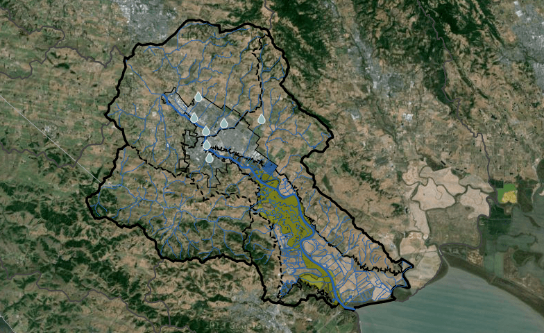
Overview: Students will engage themselves in the community in order to gain in depth understanding of our interactions with the Petaluma River and the implications of living in a community that consistently interconnects and is impacted by watershed. Students will investigate professions in Petaluma related to Casa Grande's Small Learning Communities and how these professions are interconnected to the Petaluma River. Students will analyze map data, public records, professional documents and engage in academic discourse with peers and community members in order to learn about our daily Interactions with the watershed.
Curriculum Highlights
Key Learning Objectives: Through working with peers and connecting with adults in the community, students will build interconnection and interactions as lower their learning objectives. Students will learn the implications of living in a community closely impacted by the watershed of a river through research of the Petaluma waterways and writing through evidence. Students will gain an understanding of Geo-literacy as it applies to our every day lives and careers.
Geoliteracy Integration: The Goal of the project is to have students interconnect with local environment and community through a rigorous and relevant common core base set of student outcomes. After thorough research students will add real data to the existing map, expressing the implications professions and lives are shaped by the Petaluma River and its watershed. Student work will demonstrate interconnections and interactions through research analysis and publishing.
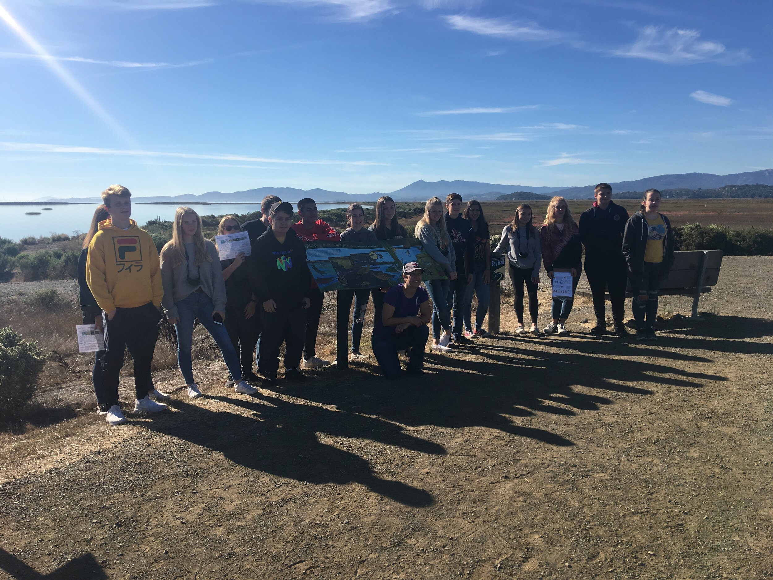
Fieldwork Activities:
Students partake in interviewing community members in order to provide oral histories and build current information on our interactions with the River. Students will seek out people who have professions that are both related to their current (or future on the 9th grade level) cluster and interview them.
Students will develops questions relevant to each community member's profession and the implications our watershed has on their job. Students will then draft, transcribe and record these interviews to the online map and blog via Podcast and video.
Students will be constantly working with the online data, they will have to go to the professionals in order to observe the work conducted by these community members and witness first hand the implications of working in a river community. Students will analyze, annotate and discuss primary documents related to the river's history, Petaluma, and the professions they are researching. Students will work together to create Google presentations for their peers.
CA Curriculum Standards Addressed:
Integrate and evaluate multiple sources of information presented in diverse formats and media (e.g., visually, quantitatively, as well as in words) in order to address a question or solve a problem.
Analyze in detail how a complex primary source is structured, including how key sentences, paragraphs, and larger portions of the text contribute to the whole.
Students analyze human modifications of landscapes and examine the resulting environmental policy issues.
Students use a variety of maps and documents to interpret human movement, including major patterns of domestic and international migration, changing environmental preferences and settlement patterns, the frictions that develop between population groups, and the diffusion of ideas, technological innovations, and goods.
READ MORE about the CA Curriculum Standards addressed by this project.